Urban Planning and Development GIS for City of Toronto
Explore Our Portfolio: Showcasing Success Stories in GIS & Web GIS Innovation and Development.


Portfolio
Urban Planning and Development GIS for City of Toronto: Smart City Solutions through Geospatial Technology
Global GeoSoft developed an advanced GIS platform Urban Planning and Development for the City of Toronto’s Urban Planning Department. This platform enabled planners to visualize and analyze urban growth patterns, zoning regulations, and infrastructure development. The solution provided a user-friendly interface with interactive maps, allowing for better decision-making in urban development projects.
- Clients Detail
- Sevices Provide
- Project Timeline
- Location
- City of Toronto Urban Planning Department
- Custom WebGIS Development
- 90 days for Completions
- Ontario, Canada
Projects Detail
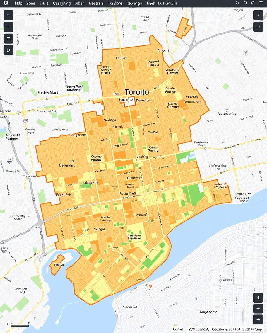
The Urban Planning and Development GIS project involved creating a highly interactive platform that enabled city planners to assess current and future urban development scenarios. The platform featured layers displaying zoning regulations, infrastructure projects, and population growth trends.
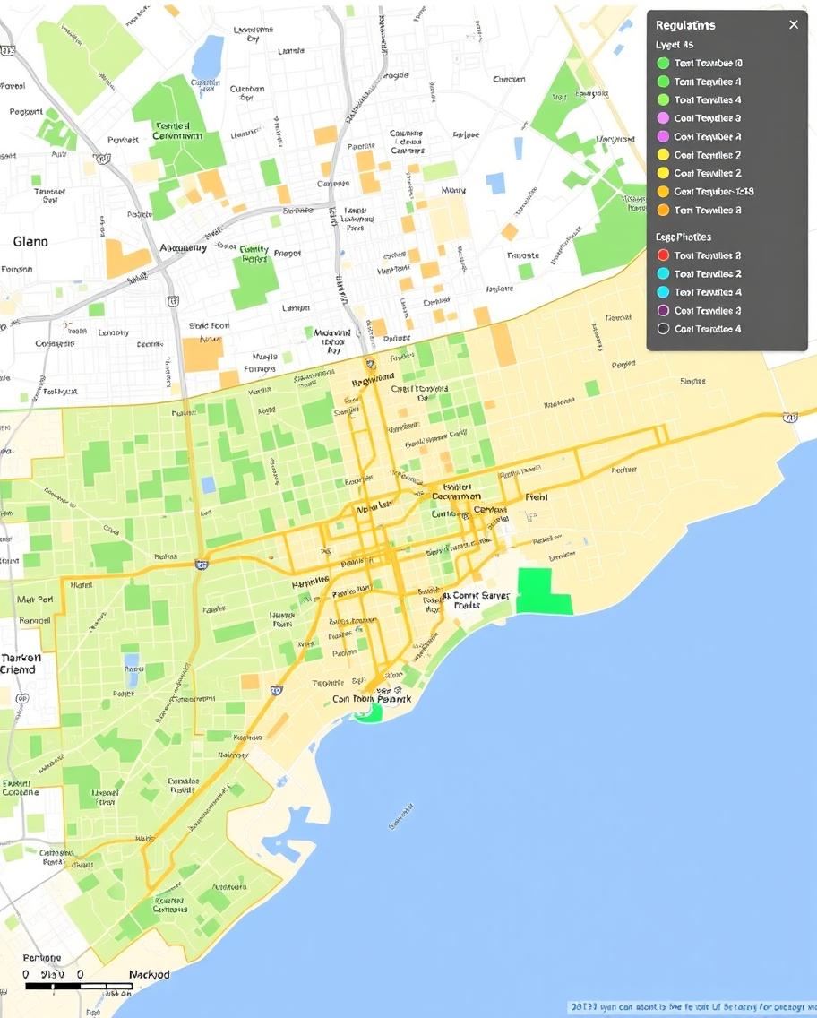
With tools for spatial analysis and scenario modeling, planners could explore the potential impact of new developments on traffic, green spaces, and public services. The platform also supported community engagement by providing accessible maps that residents could use to understand planned developments in their neighborhoods.
Global GeoSoft’s Urban Planning and Development GIS project for the City of Toronto was a transformative initiative aimed at supporting the city’s smart growth objectives. The project involved developing an interactive GIS platform that allowed urban planners to visualize and analyze the city’s zoning regulations, infrastructure projects, and population growth patterns. By integrating diverse data sources, the platform provided a unified view of the city’s current and future development scenarios, enabling planners to make data-driven decisions that balanced growth with sustainability.
The Urban Planning and Development platform featured advanced tools for spatial analysis, which allowed planners to simulate the impact of new developments on the city’s transportation network, public services, and green spaces. By visualizing potential scenarios, planners could assess the implications of various zoning changes, infrastructure expansions, and population shifts. This capability was particularly valuable in addressing the challenges of urban sprawl, congestion, and environmental sustainability, which are critical issues for a rapidly growing metropolis like Toronto.
A unique aspect of the Urban Planning and Development project was its focus on community engagement. The platform included a public-facing interface that allowed residents to view and comment on planned developments in their neighborhoods. This feature fostered greater transparency and participation in the urban planning process, helping to build public trust and support for the city’s development initiatives. Through this project, Global GeoSoft not only provided Toronto with a powerful planning tool but also helped to create a more inclusive and responsive urban development process.
The Urban Planning and Development project also focused on integrating environmental impact assessments into the urban planning process. By using GIS technology, planners were able to visualize and assess the potential environmental consequences of various development projects. This included analyzing the effects of new buildings, road expansions, and infrastructure developments on natural habitats, water resources, and air quality. By factoring in environmental data early in the planning stages, Toronto was able to make more informed decisions that prioritized sustainability and minimized ecological disruption.
Another important aspect of the Urban Planning and Development project was its scalability and adaptability. The GIS platform was designed to evolve alongside Toronto’s urban landscape, accommodating future growth and new data inputs as the city expanded. As new zoning laws, demographic trends, or technological innovations emerged, the Urban Planning and Development platform could be updated to reflect these changes, ensuring that the city’s urban planning tools remained relevant and effective. This long-term flexibility helped future-proof Toronto’s urban development efforts, allowing the city to stay ahead of its growing challenges and opportunities.
GIS Application Development Consultation
Global GeoSoft’s GIS Application Development Consultation for the City of Toronto focused on designing a scalable, user-friendly platform that could handle the complex needs of urban planning. The consultation included advice on integrating diverse data sources, optimizing the platform’s performance, and ensuring that the system could support the city’s long-term smart city goals. Global GeoSoft also provided guidance on training city staff and engaging with the public through the platform.
Our Other Project
- Collaborative Crime Mapping Sol.
- Geo-Collaborative Epidemic Control
- Disaster Response and Management
- GIS-Driven Urban Expansion
- GIS-Enhanced Cooperative Work
- Railways Assets Mgmt. System