GIS-enabled Urban Expansion System
Explore Our Portfolio: Showcasing Success Stories in GIS & Web GIS Innovation and Development.


Portfolio
GIS-Enabled Urban Expansion System
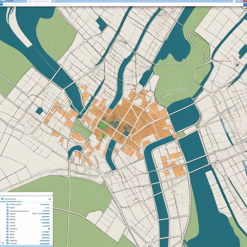
The GIS-Enabled Urban Expansion System, developed by Global GeoSoft, aimed to support the City of Sydney’s efforts to manage urban growth effectively. The GIS-Enabled Urban Expansion System involved creating a GIS platform that provided planners with the tools needed to visualize and analyze urban development patterns.
- Clients Detail
- Sevices Provide
- Project Timeline
- Location
- City of Sydney
- GIS Consulting Services
- 90 days for Completions
- Sydney, Australia
Projects Detail
The platform GIS-Enabled Urban Expansion System allowed urban planners to assess the impact of new developments on infrastructure, transportation networks, and environmental sustainability. By integrating data from various sources, including zoning regulations, population growth forecasts, and environmental studies, the system provided a comprehensive view of the city’s future development scenarios.

Global GeoSoft also focused on enhancing community engagement by developing a public-facing interface that allowed residents to view and comment on proposed developments. This feature of GIS-Enabled Urban Expansion System fostered greater transparency and participation in the urban planning process.
Project Summary
The GIS-Enabled Urban Expansion System was a strategic initiative by Global GeoSoft to support the City of Sydney in managing its rapid urban growth. This project aimed to develop a GIS-based platform that would enable urban planners to visualize, analyze, and manage urban expansion in a way that balanced growth with sustainability. By integrating data from various sources, such as zoning regulations, population forecasts, and environmental impact studies, the platform provided a comprehensive overview of the city’s future development scenarios.
One of the primary challenges addressed by the GIS-Enabled Urban Expansion System was the need to assess the impact of new developments on existing infrastructure and the environment. The platform allowed planners to evaluate different growth scenarios, helping them make informed decisions about where and how to expand the city. This included analyzing the effects of new developments on transportation networks, public services, and green spaces. By providing a detailed, data-driven approach to urban planning, the platform helped ensure that Sydney’s growth was both sustainable and well-managed.
A key feature of the GIS-Enabled Urban Expansion System was its focus on community engagement. Global GeoSoft developed a public-facing interface that allowed residents to view and comment on proposed developments. This transparency not only fostered greater trust between the city and its residents but also provided valuable feedback that could be incorporated into planning decisions. The platform’s ability to facilitate meaningful community participation was a significant achievement, setting a new standard for how cities can engage with their citizens in the planning process.
Additionally, the project emphasized adaptive management, allowing planners to adjust strategies based on real-time data and changing urban dynamics. This flexibility ensured that the GIS-Enabled Urban Expansion System remained relevant as the city evolved. By incorporating ongoing data collection and analysis, Sydney could proactively address emerging challenges, further enhancing the city’s resilience to growth pressures. Through this innovative approach, the project not only transformed urban planning in Sydney but also established a robust framework for future urban development initiatives.
Global GeoSoft provided extensive consultation services throughout the project, working closely with Sydney’s urban planning department to ensure that the platform met their specific needs. This included advising on data integration, system architecture, and user interface design. The project’s success has positioned Sydney as a leader in using GIS technology for urban planning, providing a model for other cities facing similar challenges. The GIS-Enabled Urban Expansion System is now an essential tool in Sydney’s ongoing efforts to manage growth responsibly.
GIS Application Development Consultation
Global GeoSoft provided consultation on system design, data integration, and community engagement strategies. The team worked closely with the City of Sydney to ensure that the platform met the needs of both urban planners and the broader community.
Our Other Project
- Collaborative Crime Mapping Sol.
- Geo-Collaborative Epidemic Control
- Disaster Response and Management
- GIS-Driven Urban Expansion
- GIS-Enhanced Cooperative Work
- Railways Assets Mgmt. System