Agricultural Land Use Mapping for Sustainable Farming: Empowering Farmers with Geospatial Data
Explore Our Portfolio: Showcasing Success Stories in GIS & Web GIS Innovation and Development.


Portfolio
Agricultural Land Use Mapping for Sustainable Farming: Empowering Farmers with Geospatial Data
Global GeoSoft Canada partnered with the Saskatchewan Department of Agriculture to develop a comprehensive GIS-based land use mapping solution aimed at revolutionizing agricultural practices. This innovative project provided farmers with highly detailed and accurate maps that included vital information such as soil types, crop suitability zones, water resources, and land productivity. By utilizing GIS-based land use mapping, farmers were empowered to make data-driven, informed decisions about land management, crop rotation, and planning. The solution helped optimize the use of their agricultural resources, ensuring better sustainability, improved crop yields, and more efficient water usage. With GIS-based land use mapping, farmers gained a powerful tool to enhance their operational efficiency while promoting environmentally sustainable farming practices across Saskatchewan.
- Clients Detail
- Sevices Provide
- Project Timeline
- Location
- Montreal Transit Authority
- Spatial Analysis & Mapping
- 90 days for Completions
- Saskatchewan, Canada
Projects Detail
The Agricultural Land Use Mapping project involved the development of a GIS platform that provided farmers with critical insights into soil types, crop suitability, water resources, and land management practices. The platform featured interactive maps with layers displaying various agricultural indicators, allowing farmers to plan their activities more efficiently and sustainably. Optimize agricultural practices with sustainable land use mapping. Improve crop yields, manage resources efficiently, and support eco-friendly farming in Canada.

The project also included training sessions for farmers to help them fully utilize the platform’s capabilities. By integrating data from multiple sources, the platform enabled the Saskatchewan Department of Agriculture to support sustainable farming practices across the province.
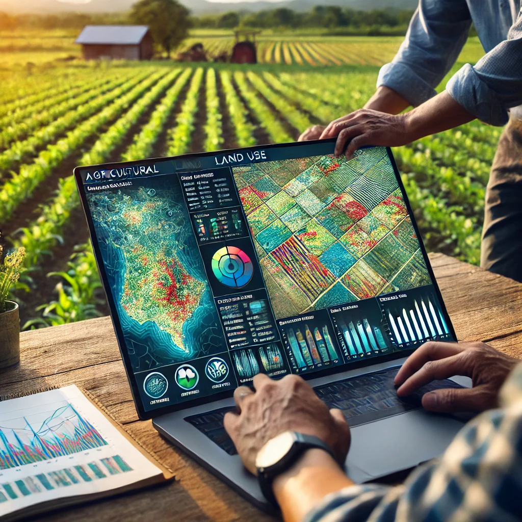
The Agricultural Land Use Mapping project, undertaken by Global GeoSoft in collaboration with the Saskatchewan Department of Agriculture, was a groundbreaking initiative aimed at promoting sustainable farming practices through the use of geospatial technology. The project involved developing a GIS platform that provided farmers with detailed maps and data layers on soil types, crop suitability, water resources, and land management practices. This platform enabled farmers to make informed decisions about their land use, resulting in more efficient and sustainable agricultural practices.
One of the core features of the platform was its ability to integrate data from various sources, including remote sensing, satellite imagery, and field surveys. This comprehensive data set allowed farmers to visualize their land’s characteristics in detail, helping them to select the most suitable crops, optimize irrigation, and manage soil health. By providing a clear picture of land resources, the platform empowered farmers to maximize productivity while minimizing environmental impact, such as soil degradation and water waste.
The project also included an educational component, with Global GeoSoft conducting training sessions to ensure that farmers could fully utilize the platform’s capabilities. These sessions covered everything from basic GIS principles to advanced land management techniques, ensuring that the platform could be effectively used by all farmers, regardless of their technical expertise. The success of this project demonstrated the significant benefits of integrating GIS technology into agriculture, particularly in promoting sustainable practices that safeguard the environment and enhance food security.
GIS Application Development Consultation
Global GeoSoft provided GIS Application Development Consultation to the Saskatchewan Department of Agriculture, focusing on creating a user-friendly platform that could be easily adopted by farmers. The consultation included advice on data integration, user interface design, and the customization of tools to meet the specific needs of the agricultural community. Global GeoSoft also offered guidance on training programs and ongoing support to ensure that the platform would have a lasting impact on sustainable farming practices.
Our Other Project
- Collaborative Crime Mapping Sol.
- Geo-Collaborative Epidemic Control
- Disaster Response and Management
- GIS-Driven Urban Expansion
- GIS-Enhanced Cooperative Work
- Railways Assets Mgmt. System